Map Art of World War II: Newsmaps, Pictorial Maps and Propaganda
Newsmap for Monday, 12 June 1944, with the Normandy beachhead
The Maps of World War II · Chapter 8 of 9 · Maps for the public
Map art, Newsmaps & propaganda
The Second World War made millions of people into map readers. Newspapers, magazines, newsreels and the Army itself taught a generation to follow the war on maps, and some of those maps were works of art.
Newsmap
Every week from 1942 until after the war, the U.S. Army produced a large poster called Newsmap for posting on bulletin boards in barracks, mess halls and offices. Its front carried a map of the week’s fighting with a summary of the news from every front; its back often carried training posters, identification charts or pictures of the enemy. Newsmap was part of the Army’s orientation program, built on the idea that soldiers who understood why and where they were fighting would fight better. The issues in this gallery track the war week by week, from the long retreat of 1942 to the Normandy beachhead in June 1944.
Newsmap, week by week: 14 sheets.
Teaching the home front to read maps
Civilians learned too. Newspapers printed daily war maps; magazines such as Fortune and Life commissioned striking perspective maps that showed the world from unusual angles, from over the North Pole or looking west across the Pacific, to teach Americans that oceans no longer protected them. Department stores and oil companies gave away war maps so families could follow sons and husbands overseas. Many of those commercial maps remain under copyright; the government-made maps in this gallery are free to use.
Persuasion
Maps persuade quietly. A map that colors an enemy’s conquests in black, or draws arrows reaching toward your coast, argues without seeming to. The U.S. government’s prewar posters on the dangers of fascism, Allied maps of Axis aggression, and German and Japanese maps of encirclement and destiny all used the authority of the map to make a case. Read them as arguments.
Maps in training
Even a pamphlet about malaria could be a map. The U.S. Army’s 1943 booklet This Is Ann, written to teach soldiers about the Anopheles mosquito and illustrated by Theodor Geisel, better known as Dr. Seuss, sits in this gallery beside identification charts and orientation maps that taught soldiers where they were going and what they would find there.
Map art, Newsmaps and propaganda
Newsmaps, pictorial and orientation maps and propaganda maps. Filter by type and year. 100 maps in 5 groups: Newsmaps, Propaganda and posters, General maps, Historical maps, More maps.
Newsmaps (1 of 2) 25 maps
Federal newsmapsPublished by Army Orientation Course, Morale Services Division, War Dept · 1942 · World & home fronts
Weekly; Began with vol. 1, no. 1 (Apr. 27, 1942) and ceased with v. 5, no. 4 (May 13, 1946).; Title from opening screen (viewed March 10, 2008).; Prepared and distributed by Army Orientation Course.; "Prepared from public sources of information."; Vol. 1, no.
This file was contributed to Wikimedia Commons by State Library of Ohio as part of a cooperation project.. Public domain. SourceFederal newsmapsPublished by Army Orientation Course, Morale Services Division, War Dept · 1942 · World & home fronts
Weekly; Began with vol. 1, no. 1 (Apr. 27, 1942) and ceased with v. 5, no. 4 (May 13, 1946).; Title from opening screen (viewed March 10, 2008).; Prepared and distributed by Army Orientation Course.; "Prepared from public sources of information."; Vol. 1, no.
This file was contributed to Wikimedia Commons by State Library of Ohio as part of a cooperation project.. Public domain. SourceFederal newsmapsPublished by Army Orientation Course, Morale Services Division, War Dept · 1942 · World & home fronts
Weekly; Began with vol. 1, no. 1 (Apr. 27, 1942) and ceased with v. 5, no. 4 (May 13, 1946).; Title from opening screen (viewed March 10, 2008).; Prepared and distributed by Army Orientation Course.; "Prepared from public sources of information."; Vol. 1, no.
This file was contributed to Wikimedia Commons by State Library of Ohio as part of a cooperation project.. Public domain. Source1943 Army Orientation Course Newsmap of the Mediterranean Sea and North AfricaThe Army Orientation Branch · 1943 · Mediterranean & North Africa
NEWSMAP Monday, June 21, 1943. Week of June 10 to June 17.
Public domain. SourceNewsmap – Monday, October 26, 1942United States GPO · 1942 · World & home fronts
Newsmap – Volume I, Monday, October 26, 1942
Public domain. SourceNewsmap — Monday, September 14, 1942United States GPO · 1942 · World & home frontsPublic domain. SourceNEWSMAP For the Armed Forces. V-E Day + 15 Weeks – 192nd Week of U.S. Participation in the WarArmy Information Branch · 1945 · World & home frontsPublic domain. SourceNewsmap Monday June 12, 1944 – map showing the Normandy landingsUnited States GPO · 1944 · Western EuropePublic domain. SourceNewsmap Monday June 12, 1944 showing the Normandy landingsUnited States GPO · 1944 · Western EuropePublic domain. SourceNewsmap – Volume 1, Number 3Department of Transportation. U.S. Coast Guard. U.S. Coast Guard Academy. · 1942 · World & home fronts
The original finding aid described this as: Newsmap for the week of May 1 to May 8.
This file was contributed to Wikimedia Commons by National Archives and Records Administration as part of a…. Public domain. SourceNational Archives (NARA) Still Picture Identifier: 26-nm-1-43bThis tag does not indicate the copyright status of the attached work. · 1943 · Western Europe(National Archives Catalog, National Archives and Records Administration , U.S.A.). Public domain. SourceNational Archives (NARA) Still Picture Identifier: 26-nm-1-46bAuthor not provided (descriptive uniform and insignia illustrations by uncredited… · 1943 · Western Europe(National Archives Catalog, National Archives and Records Administration , U.S.A.). Public domain. SourceNational Archives (NARA) Still Picture Identifier: 26-nm-1-48bAuthor not provided (descriptive uniform and insignia illustrations by uncredited… · 1943 · China, Burma & India(National Archives Catalog, National Archives and Records Administration , U.S.A.). Public domain. SourceNational Archives (NARA) Still Picture Identifier: 26-nm-2-40bThis tag does not indicate the copyright status of the attached work. · 1944 · Western Europe(National Archives Catalog, National Archives and Records Administration , U.S.A.). Public domain. SourceNational Archives (NARA) Still Picture Identifier: 26-nm-1-38bAuthor (illustrator) not provided · 1943 · World & home frontsNational Archives Catalog, National Archives and Records Administration , U.S.A.. Public domain. SourceLiberation of Rome, Newsmap, June 12, 1944United States GPO · 1944 · Mediterranean & North Africa
Newsmap Monday June 12, 1944 showing the Normandy landings
Public domain. SourceNewsmap – The Middle EastArmy Information Branch · 1946 · World & home fronts
Map shows Middle East. "A troop information program map." Relief shown by hachures. Table lists countries, capitals, area in sq. miles, and population. Map key indicates oil fields, oil pipe lines, principal railways, principal roads.
Public domain. SourceNewsmap for the Armed Forces – Code for the ConqueredArmy Information Branch · 1945 · Western Europe
Text describes principal points which disestablish the Reich and eliminate its war-making powers Photograph: A group of men in uniform and in street dress stand in the foreground appearing to read the code for the conquered.
Public domain. SourceNewsmap for the Armed Forces – U.S. role in world affairsArmy Information Branch · 1945 · Pacific
Text describes U.S. role in world affairs and is keyed to map. Map projection is "designed to minimize distortions along the 40th parallel which runs approximately through Tokyo and Washington".
Public domain. SourceNewsmap for the Armed Forces – UNO, 51 Nations Unite For PeaceArmy Information Branch · 1946 · Western Europe
The text highlights the founding of the UNO. Map: UNO members, their colonies and territories. Photographs: the opening session of the UNO at Central Hall, London, 10 January, 1945; American delegates to the UNO in conference.
Public domain. SourceNewsmap – Maps are not true for all purposesArmy Information Branch · 1942 · World & home fronts
Information about the tradeoffs involved in choosing between map projections, making the basic point that “maps are not true for all purposes.” It includes numerous diagrams illustrating the advantages and disadvantages of conic, Mercator and azimuthal…
Public domain. SourceNewsmap – July 9, 1945Army Information Branch · 1945 · Pacific
An edition of Newsmap, showing the Allied advances in the Pacific front
Public domain. SourceNewsmap – May 7, 1945Army Information Branch · 1945 · China, Burma & India
Maps show military activities throughout Europe, China, and the Philippines during the week. Inset map: Pacific action Photograph: U.S. Sixty-Ninth Division Infantrymen greet Red Army soldiers on the Elbe River bridge at Torgau.
Public domain. SourceNewsmap – Potsdam briefsArmy Information Branch · 1945 · Eastern Front
Summary of Potsdam conference. Map shows European boundaries as of January 1938. Inset map details administration of eastern Germany and East Prussia.
Public domain. SourceNewsmap – June 12, 1944Army Information Branch · 1944 · China, Burma & India
Text describes action on various war fronts: France, Eastern front, Italy, Pacific, China and Southeast Asia. Maps: Schouten Islands, Channel Coast and central Italy.
Newsmap – September 17, 1945Army Information Branch · 1945 · Pacific
Major bases proposed for postwar U.S. Navy; Japan: American troops arrive to the enemy homeland.
Public domain. SourceVerso of This is Ann… she drinks your blood!US ARMY · 1943 · World & home fronts
They Kept the Sea Lanes Open: Invest in the Victory Liberty Loan
Public domain. SourceA Nazi eagle spreads its wings over a Swastika covered Earth1944 · Western EuropeThis file was contributed to Wikimedia Commons by Hennepin County Library as part of a cooperation project.. Public domain. SourceLeo Hermle, Alexander Vandegrift, and Julian Smith, Wellington, New Zealand, 21 September 1943USMC Archives from Quantico, USA · 1943 · World & home frontsLeo Hermle, Alexander Vandegrift, and Julian Smith, Wellington, New Zealand, 21 September 1943. CC BY 2.0. SourceWW2 Japanese Army Uniforms Newsmap Vol No US Government National Archives Unrestricted Public domain 26-nm-2-42 002…Uncredited uniform illustrations from the Joint Army Navy J.A.N. · 1944 · Pacific
World War II Era "Newsmap – Volume 2, Number 42" Publication. 2/7/1944. National Archives (NARA) Still Picture Identifier: 26-nm-2-42b. Jap Army Uniforms (see Uniforms of the Imperial Japanese Army and Ranks of the Imperial Japanese Army ).
(National Archives Catalog, National Archives and Records Administration , U.S.A.). CC BY-SA 4.0. SourceWW2 Italian Navy Uniforms Insignia Newsmap Vol No US Government National Archives NARA Unrestricted Public domain…Author not provided (descriptive uniform and insignia illustrations by uncredited… · 1943 · Mediterranean & North Africa
National Archives (NARA) Still Picture Identifier: 26-nm-1-40b. Italian Navy Uniforms and Insignia. Italian Navy Uniforms and Insignia of World War II, World War II Era "Newsmap – Volume 1, Number 40" Publication. 1/25/1943 Unrestricted access and use.
(National Archives Catalog, National Archives and Records Administration , U.S.A.). CC BY-SA 4.0. SourceNational Archives (NARA) Still Picture Identifier: 26-nm-2-20bAuthor (illustrator) not provided · 1943 · Western EuropeNational Archives Catalog, National Archives and Records Administration , U.S.A.. CC BY-SA 4.0. SourceWW2 British Battle Dress Newsmap Vol 1 No 17 1942-08-17 US Government National Archives NARA Unrestricted Public domain…Author (illustrator and photographers) not provided · 1942 · World & home fronts
National Archives (NARA) Still Picture Identifier: 26-nm-1-17b. British Battle Dress. World War II Era "Newsmap" – Volume 1, Number 17, 8/17/1942; The obverse shows the Newsmap for the week of August 7 to August 14.
National Archives Catalog, National Archives and Records Administration , U.S.A.. CC BY-SA 4.0. Source
Propaganda and posters (1 of 2) 29 maps
He’s Coming South – the Word Now is Must Safety Demands ObedienceDepartment of Information (Australia) · 1942 · Pacific
On 7 December 1941, Japan launched a series of attacks on British and American territories in Asia and the Pacific. The attacks shocked the world, although fears about Japan’s imperialist aims had in fact been growing for decades.
Poster "He’s Coming South" Propaganda poster referring to the threat of Japanese invasion. A Japanese soldier is stepping across the globe towards Australia with the Imperial Japanese flag behind him.
Also found at Australian War Memorial image ARTV09225. Public domain. SourceFront Lines of Labor Help Win the War, 1942 – 1945The U.S. National Archives · 1942 · World & home fronts
Original Caption: "Front Lines of Labor Help Win the War, 1942 – 1945" U.S. National Archives’ Local Identifier: NWDNS-44-PA-846 From: Series: World War II Posters, (Record Group 44) Created by: Office for Emergency Management. Office of War Information.
Front Lines of Labor Help Win the War, 1942 – 1945. No restrictions. SourceAll About San Francisco1943 · World & home fronts
This pictorial map, “All About San Francisco” is beautifully illustrated in the popular 1940’s art-deco style. This black, white and red street map and birds-eye view of San Francisco also features a detailed map of the Golden Gate Park and Panhandle on the…
This file was provided to Wikimedia Commons by Geographicus Rare Antique Maps , a specialist dealer in rare…. Public domain. SourceUS World War II poster against labor discrimination – Americans AllWar Manpower Commission · 1942 · World & home fronts
Americans All — ". . . it is the duty of employers and labor organizers to provide for the full participation of all workers without discrimination because of race, creed, color or national origin." Franklin D. Roosevelt
Public domain. Source1943 Chapin Pictorial Map of the Pacific Fortified Positions during World War II for TIME MagazineM. Chapin, Jr. · 1943 · PacificPublic domain. SourceJapan, the target – a pictorial Jap-mapChase, Ernest Dudley, 1878 – 1966 · 1943 · Pacific
Title Japan, the target : a pictorial Jap-map Cartographer Chase, Ernest Dudley, 1878- Name on Item Ernest Dudley Chase of Winchester, Mass. Date [1943] Format Maps/Atlases Location Boston Public Library Norman B.
Chase, Ernest Dudley. "Japan, the target." Map. Winchester, Massachusetts: Ernest Dudley Chase, [1943].. Public domain. SourceThe World at war, 1943Army Orientation Course · 1943 · World & home fronts
World War II map of the world, Van der Grinten Projection. Shows points where U.S. forces are stationed, political boundaries, roads, railways, rivers. U.S. Forces station shown pictorially. Includes title cartouche, legend, and distance table.
David Rumsey Map Collection, list no 13580.000. Public domain. SourceКАВКАЗ~КРЫМ~СССР~1939~USSR~CAUCASUS~CRIMEA~, Contributors: Intourist (Firm) · 1939 · Eastern Front
Caucasus and Crimea tourist map established by Intourist travel firm in USSR, 1939
Caucasus Crimea pictorial map USSR, Moscow, 1939 Contributors: Intourist (Firm). Public domain. SourcePictorial United States, 1943Miguel Covarrubias · 1943 · World & home fronts
Pictorial map of the United States, with an explanation by the artist-mapmaker, beginning: "Now in time of war, we are latently awakening to the grandeur, color and infinite variety of this America we fight to defend…". Published on the Esquire magazine.
Public domain. Source"American Labor — Producing for Attack," 1942 – 1945The U.S. National Archives · 1942 · World & home fronts
Original Caption: "American Labor — Producing for Attack," 1942 – 1945 U.S. National Archives’ Local Identifier: NWDNS-44-PA-351 From: Series: World War II Posters (Record Group 44) Created by: Office for Emergency Management. Office of War Information.
"American Labor — Producing for Attack," 1942 – 1945. No restrictions. Source"Free Labor Will Win," 1942 – 1945The U.S. National Archives · 1942 · World & home fronts
Original Caption: "Free Labor Will Win," 1942 – 1945 U.S. National Archives’ Local Identifier: NWDNS-44-PA-835 From: Series: World War II Posters (Record Group 44) Created by: Office for Emergency Management. Office of War Information.
"Free Labor Will Win," 1942 – 1945. No restrictions. SourceUniforms and ranks and insignia of the German Army (1935–1945) ( Wehrmacht Her of Nazi Germany )This tag does not indicate the copyright status of the attached work. · 1942 · Western Europe(National Archives Catalog, National Archives and Records Administration , U.S.A.). Public domain. SourceAlaskadeathtrapWPA Art Project (U.S. government) Artist’s signature "Grigmare · 1941 · Pacific
Alaska – death-trap for the Jap / Grigware. Propaganda Poster for Thirteenth Naval District, United States Navy, showing a rat wearing a rising sun fez, representing Japan, approaching a mousetrap labeled "Army / Civilian / Navy", on a background map of the…
Library of Congress REPRODUCTION NUMBER: LC-USZC2-985 (color film copy slide). Public domain. SourceAlaska Death TrapWPA Art Project (U.S. government) · 1941 · Pacific
Alaska – death-trap for the Jap / Grigware. Propaganda Poster for Thirteenth Naval District, United States Navy, showing a rat wearing a rising sun fez, representing Japan, approaching a mousetrap labeled "Army / Civilian / Navy", on a background map of the…
Library of Congress REPRODUCTION NUMBER: LC-USZC2-985 (color film copy slide). Public domain. SourcePacific War US Propaganda Leaflet No.4011944 · Pacific
This propaganda leaflet was dropped to Japan by US Armed Forces after the Battle of Saipan .
Public domain. SourcePacific war US Propaganda Leaflet "Where is the Imperial Navy?"(Back)1943 · Pacific
This propaganda leaflet was dropped to Japanese military in Tarawa by US Armed Forces.
Public domain. SourcePacific war US Propaganda Leaflet NO.20931945 · Pacific
This propaganda leaflet was dropped to Japan by US Armed Forces.
Public domain. SourceSarpsborg juli 1942Riksarkivet (National Archives of Norway) from Oslo, Norway · 1942 · Western Europe
Photo from " Borgartinget ", a political propaganda rally of Nasjonal Samling (NS), Quisling’s Norwegian Nazi party before and during World War II, held in Sarpsborg in German occupied Norway on June 20-21, 1942, with the Hirden , uniformed party members…
Sarpsborg juli 1942. No restrictions. SourceRynek Kościuszki world war II nazi propaganda mapRakoon · 1942 · World & home frontsOwn work. Public domain. SourceS25World & home fronts
Poster from the Spanish Revolution
Public domain. SourceLick Them Over ThereDirector of Public Information, Ottawa · 1939 · World & home fronts
Lick Them Over There! (Canada)
McGill University Library, Rare Books and Special Collections, Canadian War Poster Collection, Reference no.. Public domain. SourceStep by Step to VictoryDepartment of National Defence, Ottawa · 1939 · Western Europe
Step by Step to Victory … Buy Victory Bonds"; poster depicts a map, with small flags placed on the countries which have been liberated from the Germans. A large hand prepares to place a flag on Germany.
Wartime Information Board, Ottawa McMaster University Libraries, Identifier: 00001663. Public domain. SourceSoviet territory lost by December 1941 Why We Fight no. 5The Why We Fight series was created by the US Army Pictorial Services; · 1941 · Eastern Front
A graphic depicting Soviet territory lost by December 1941 as a result of Operation Barbarossa from the The Battle of Russia , the fifth film in the Why We Fight series.
Screenshot taken from The Battle of Russia .. Public domain. SourceFortified Japanese Pacific islands Why We Fight no. 6The Why We Fight series was created by the US Army Pictorial Services. · 1944 · China, Burma & India
An animation depicting the Pacific island holdings fortified by Japan from the The Battle of China , the sixth film in the Why We Fight series.
Screenshot taken from The Battle of China .. Public domain. SourceJapanese bayonet into map of Manchuria Why We Fight no. 6The Why We Fight series was created by the US Army Pictorial Services. · 1944 · China, Burma & India
An animation depicting the Japanese invasion of Manchuria in the form of a bayonet thrust into a map of Manchuria from the The Battle of China , the sixth film in the Why We Fight series.
Screenshot taken from The Battle of China .. Public domain. SourceJapanese planned conquests to attack America Why We Fight no. 6The Why We Fight series was created by the US Army Pictorial Services. · 1944 · China, Burma & India
An animation depicting planned Japanese conquests of the eastern half of the USSR, China, India, mainland and insular Southeast Asia, and Australia to form the basis for a means of attacking the United States from the Pacific.
Screenshot taken from The Battle of China .. Public domain. SourcePacific war US Propaganda Leaflet"I am very sorry for you."(front)1943 · Pacific
This propaganda leaflet was dropped to Japanese military in the Kiska by US Armed Forces.
Public domain. SourcePacific war US Propaganda Leaflet NO.144-J-1(front)1945 · Pacific
This propaganda leaflet was dropped to Japan by US Armed Forces. Soviet Union soldier and the U.S. soldier shaking hands on Japan.
Coming South (AWM ARTV09225)The original uploader was Nick Dowling at English Wikipedia . · 1942 · World & home fronts
Australian War Memorial (AWM) catalog number ARTV09225 Sourced from: Copyright: The poster was made and published in 1942 by an unknown artist working for the Australian Government. As a result it is no longer under copyright.
This tag does not indicate the copyright status of the attached work.. Public domain. Source
General maps 16 maps
Europe as viewed from the USSR, 1944Richard Edes Harrison · 1944 · Eastern Front
This map was drawn by Richard Edes Harrison. It shows Europe seen from the Soviet Union.
David Rumsey Map Collection, list no 6767.001. Public domain. SourceMap of the Pacific Ocean and Far East, 1943Army Orientation Course · 1943 · Pacific
Physical-political map of Eastern and Southeast Asia and Western Pacific
Truman Library. Public domain. SourceMap of the European TheaterArmy Orientation Course · 1944 · Western Europe
Map of Europe that shows railroads, rivers and pre-war boundaries
Truman Library. Public domain. SourceBuffalo courier express ww2 add1Buffalo Courier Express · 1945 · World & home fronts
Front Page(Buffalo Courier Express) World War Two Bond Ad
Public domain. SourceDans le combat ils forgent une patrie libre et fraternelle1945 · Mediterranean & North Africa
Illustration from the exhibition "Yugoslavia" held in Algeria on 8 February 1945 by a Yugoslav military mission.
Exhibition "Yugoslavia" held in Algeria on 8 February 1945;. Public domain. SourceConfiance…Ses Amputations Se Poursuivent Méthodiquement1942 · World & home frontsPublic domain. SourceОборона Одессы марка 2011Post of Ukraine · 1941 · Eastern Front
70 лет обороны Одессы (1941). Оригинальная почтовая марка. Укрпочта, 2011. На марке изображена советская медаль "За оборону Одессы".
own scan by Vizu. Public domain. SourceStatsakten. Akershus. 1942-02-01Riksarkivet (National Archives of Norway) from Oslo, Norway · 1942 · Western Europe
RA/PA-1209/Ue 94/ img056 «Statsakten» var en seremoni på Akershus slott i Oslo under andre verdenskrig 1. februar 1942 da rikskommissar Josef Terboven innsatte Vidkun Quisling , leder for Nasjonal Samling (NS), som « ministerpresident » i Norge , og de…
Statsakten. Akershus. 1942/02/01.. No restrictions. SourceStatsakten. 1942-02-01Riksarkivet (National Archives of Norway) from Oslo, Norway · 1942 · Western Europe
RA/PA-1209/Ue 94/ img061 «Statsakten» var en seremoni på Akershus slott i Oslo under andre verdenskrig 1. februar 1942 da rikskommissar Josef Terboven innsatte Vidkun Quisling , leder for Nasjonal Samling (NS), som « ministerpresident » i Norge , og de…
Statsakten. 1942/02/01.. No restrictions. SourceStatsakten. Akershus. 1942-02-01Riksarkivet (National Archives of Norway) from Oslo, Norway · 1942 · Western Europe
RA/PA-1209/Ue 94/ img071 «Statsakten» var en seremoni på Akershus slott i Oslo under andre verdenskrig 1. februar 1942 da rikskommissar Josef Terboven innsatte Vidkun Quisling , leder for Nasjonal Samling (NS), som « ministerpresident » i Norge , og de…
Statsakten. Akershus. 1942/02/01.. No restrictions. SourceWorld War II Allied uniforms and insigniaUnited States Army. Services of Supply. Special Service Division. · 1943 · China, Burma & India
Uniforms and insignia for the armed forces of the United States, U.S.S.R., France, Poland, China, and the British Empire are illustrated. Additional text describes the salutes and forms of address used by each country’s military.
Public domain. SourceWhy We Fight – The Nazis Strike Heartland imageja:ロバート・キャプラ · 1943 · World & home fronts
1943『Why We Fight: The Nazis Strike』におけるハートランドの図
YouTube : – View/save archived versions on archive.org. Public domain. SourceII World War contrailsSgt. Stanley M. Smith · 1943 · World & home fronts
B-17 of J Group. Captions from published books : " FIGHTERS protect bomber formations at high altitudes where thin, freezing air makes vapor trails like these left by P-47s . " [ 1 ]
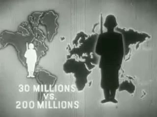
390th.org. Public domain. SourceWWII Divide and Conquer 5World & home frontsPublic domain. SourceWWII Divide and Conquer 10World & home frontsPublic domain. SourceWhywefight30vs200Frank Capra · 1945 · World & home fronts
From " War Comes to America " – the dire consequences for the United States of an Axis victory in Eurasia.
Screenshot from "War Comes To America". Public domain. Source
Historical maps 12 maps
Stamp of USSR 0884Post of USSR · 2008 · Eastern FrontPublic domain. SourceInvasion and total war victory mapsNorman B. Leventhal Map Center at the BPL · 2017 · World & home fronts
Zoom into at . Title: Invasion and total war victory maps : with decorations, illustrations and military and naval insignia Title (alt.): Total war battle map Victory war map Creator: Chase, Ernest Dudley Artist: Chase, Ernest Dudley Cartographer: Chase,…
Public domain. SourceVyborg Castle Museum – World War II – p27Александр Сигачёв · 2026 · World & home frontsOwn work. CC0. SourceStamp of Armenia m60Post of Armenia · 1995 · Eastern Front
Commanders: A.Sargissian and N.Safarian 89th Taman Triple Order bearer rifle division. Series: 50th Anniversary of Victory in Second World War. Stamp of Armenia.
,. Public domain. SourceSouvenir sheet of Russia stamp no. 863 – 60th anniversary of Battle of KurskRussian Post/Moscovets A., painter · 2003 · Eastern Front
Stamps of Russia. The 60th anniversary of the Kursk battle , 2003
Public domain. SourceКомандиры 390-й стрелковой дивизии И. И. Людников. С. Г. Закиян и А. Г. Бабаян1995 · World & home fronts
390-й стрелковой дивизии И. И. Людников. С. Г. Закиян и А. Г. Бабаян. Юбилейная марка Республики Армения.
scanned by Mchpv. Public domain. SourceКомандир 408-й стрелковой дивизии П. Н. Кицук. Юбилейная марка Республики АрменияMchpv · 2016 · World & home fronts
408-й стрелковой дивизии П. Н. Кицук. Юбилейная марка Республики Армения.
Own work. Public domain. SourceCarbon footprintNotnarayan · 2009 · World & home frontsOwn work. CC BY-SA 3.0. SourceBarCraft 2, Budapest 17Christo · 2005 · Eastern FrontOwn work. CC BY-SA 4.0. SourceErdély, Csíkszereda, faragott Nagy-Magyarország, 2Christo · 2017 · World & home frontsOwn work. CC BY-SA 4.0. SourceКарта золотое кольцо Боспорского царствоArkhimed · 2019 · Eastern Front
Map that shows the "Golden Ring of the Bosporian Kingdom" as part of modern Russia
Own work. CC BY-SA 4.0. SourceGreater Hungary transfer pictureRovibroni (Barna Rovács) · 2007 · Eastern FrontOwn work. CC BY-SA 4.0. Source
More maps 9 maps
The Conquest and liberation of FranceArmy Information Branch, Army Service Forces · 1944 · Mediterranean & North Africa
This chronological series of five maps celebrates the Allied soldier as the liberator of France. Each image highlights the progress of German advance across the nation and much of Europe, until the mighty combined efforts in Normandy, southern France, Italy,…
curtiswrightmaps.com. Public domain. SourceThe seat of war in the West Indies 1740Published pursuant to Act of Parliament Feb. 9 1739/40. by G. · Atlantic
English pamphlet with maps of the Caribbean and main Spanish cities in the region, published in 1740 to build public support for the ongoing war against Spain ( War of Jenkins’ Ear , 1739-1742) and to incite to the conquest of Havana, Cuba .
John Carter Brown Library. Public domain. SourceThe United States Army in World War II: deployment of troops1945 · PacificGallery: Wellcom. CC BY 4.0. SourceOver 1,250,000 Tons of Axis Shipping Sunk in the Central MediterraneanOffice for Emergency Management. Office of War Information. Domestic Operations Branch. · Mediterranean & North Africa
Country: England Printed By: Chromoworks, Ltd.
File URL Catalog record. Public domain. SourceFrench Newspaper in Britain- Wartime News and Propaganda, England, 1942 D10258Ministry of Information Photo Division Photographer · 1942 · Western EuropeThis photograph D 10258 comes from the collections of the Imperial War Museums .. Public domain. SourceOn the Move in Wartime London, 1942 D9320Ministry of Information Photo Division Photographer · 1942 · Western EuropeThis photograph D 9320 comes from the collections of the Imperial War Museums .. Public domain. SourceRous, John,, photographerThe Library of Congress · 1943 · China, Burma & IndiaNo restrictions. SourceHungarian Cultural House in Caracas, Map of the Great Hungaryprivate · 2007 · Eastern Front
Hungarian Cultural Hosue in Caracas, Venezuela. Map of the Great Hungary
Own work. Public domain. Source38,000,000 Escaped — 10,000,000 DiedRussian War Relief Inc. in New York · 1943 · Eastern FrontPublic domain. Source
University of North Texas Libraries and Library of Congress, Newsmap collections.
U.S. War Department, Army Orientation Course and Army Information Branch publications.
U.S. Army, This Is Ann (1943).
Wikimedia Commons, items credited individually.
Images are public domain (mostly U.S. federal government works and expired copyrights) or openly licensed under Creative Commons, drawn from Wikimedia Commons and the archives credited on each map. Each image links to its source file and license. Images are served through the WordPress.com image CDN for fast loading on phones. Axis maps are reproduced as historical records.
Cookie Consent
We use cookies to improve your experience on our site. By using our site, you consent to cookies.
Essential cookies enable basic functions and are necessary for the proper function of the website.
Name
Description
Duration
Cookie Preferences
This cookie is used to store the user's cookie consent preferences.
30 days
These cookies are needed for adding comments on this website.
Name
Description
Duration
comment_author_url
Used to track the user across multiple sessions.
Session
comment_author
Used to track the user across multiple sessions.
Session
comment_author_email
Used to track the user across multiple sessions.
Session
Google's current Sign in with Google client library. It renders the Google sign-in button, or the One Tap prompt, so visitors can log in to your site with their Google account. It replaces the older Google Sign-In platform library.
Set on your own domain by the Sign in with Google client library. Records whether the visitor has dismissed the One Tap sign-in prompt and for how long it should stay hidden, plus the time the library last loaded and a browsing session id used for the same purpose. Sites that pass a custom state_cookie_name will see that name instead.
180 days
g_csrf_token
Set on your own domain by the Sign in with Google client library and submitted together with the sign-in credential, so your site can confirm the sign-in came from its own page and not from a forged cross-site request.
5 minutes
Statistics cookies collect information anonymously. This information helps us understand how visitors use our website.
Google Analytics is a powerful tool that tracks and analyzes website traffic for informed marketing decisions.
Used to distinguish new sessions and visits. This cookie is set when the GA.js javascript library is loaded and there is no existing __utmb cookie. The cookie is updated every time data is sent to the Google Analytics server.
30 minutes after last activity
__utmc
Used only with old Urchin versions of Google Analytics and not with GA.js. Was used to distinguish between new sessions and visits at the end of a session.
End of session (browser)
__utmz
Contains information about the traffic source or campaign that directed user to the website. The cookie is set when the GA.js javascript is loaded and updated when data is sent to the Google Anaytics server
6 months after last activity
__utmv
Contains custom information set by the web developer via the _setCustomVar method in Google Analytics. This cookie is updated every time new data is sent to the Google Analytics server.
2 years after last activity
__utmx
Used to determine whether a user is included in an A / B or Multivariate test.
18 months
_ga
ID used to identify users
2 years
_gali
Used by Google Analytics to determine which links on a page are being clicked
30 seconds
_ga_
ID used to identify users
2 years
_gid
ID used to identify users for 24 hours after last activity
24 hours
_gat
Used to monitor number of Google Analytics server requests when using Google Tag Manager
1 minute
__utma
ID used to identify users and sessions
2 years after last activity
__utmt
Used to monitor number of Google Analytics server requests
10 minutes
_gac_
Contains information related to marketing campaigns of the user. These are shared with Google AdWords / Google Ads when the Google Ads and Google Analytics accounts are linked together.
90 days
Jetpack's built-in visitor analytics. It records page views, referring sites, search terms, and outbound link clicks, and also carries the shared visitor-tracking library used by Jetpack Instant Search and WooCommerce Analytics.

 Newsmap for Monday, 12 June 1944, with the Normandy beachhead